
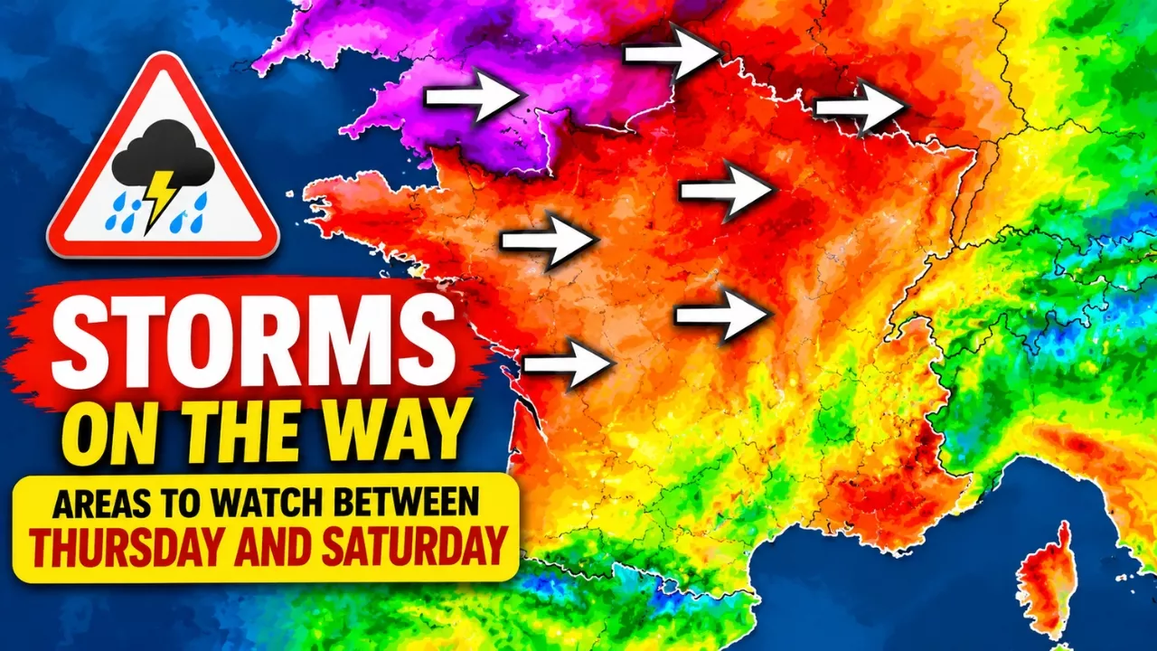
Autumn weather in France is about to change character. After a rainy start to the week in the Mediterranean, forecasters are watching a shift toward an Atlantic pattern from Wednesday 21 October. If the current model runs hold, two windy episodes could follow: one on Thursday 22 October, and a second, possibly wider one on Friday 23 and Saturday 24 October. This France storm alert is not a confirmed forecast. It is a guide to which regions deserve attention and why, based on the latest model simulations.
Why the Atlantic Is Taking Over This Week
From Wednesday, the atmospheric flow is expected to turn westerly, opening the door to a train of Atlantic weather systems. High above, a powerful jet stream, a fast ribbon of wind around nine kilometres up, is expected to cross the Atlantic toward western Europe on Thursday and Friday.
Why does this matter for people on the ground? A strong jet stream steers low-pressure systems quickly and can help them deepen. That does not mean the jet’s own wind speed will be felt at street level. It means the conditions are favourable for a lively, potentially strong sequence, and the exact track of each low will decide who gets the worst of it.
Thursday 22 October: Brittany Likely on the Front Line
The first windy spell looks focused on the north-west. European model simulations show the strongest gusts, around 100 to 120 km/h, mainly over the sea and along exposed Breton coasts, headlands and capes. How far those gusts reach inland is still unclear.
Inland, gusts above 70 km/h are possible across parts of the north-west, including Pays de la Loire, Poitou and some Norman areas, with a possible extension toward the Centre region. At this range, a small shift in the low’s track would noticeably change where the strongest gusts fall.
Friday and Saturday: The Wider and More Worrying Window
The most extensive wind signal appears around Friday 23 October, when a deep low of about 975 hPa is simulated moving quickly across southern England and the Irish Sea area. Tight pressure lines around that low favour a strong west to south-west flow. A rapid fall and rise in pressure as the low passes can also produce very violent gusts, including inland.
Models suggest gusts of 70 to 100 km/h across several western and northern areas, with the Centre, Île-de-France and Hauts-de-France also possibly affected. Exposed coasts of Brittany and the Channel could see gusts well above 100 km/h, and a few scenarios even show peaks beyond 150 km/h. Those higher figures remain a worst-case possibility, not a prediction. Intensity, timing and location may all change in the coming days.
Trees still carrying their leaves catch more wind, which is why even moderate gusts can bring down branches at this time of year.
Regional Risk at a Glance
| Day | Main areas to watch | Simulated gusts | Confidence |
|---|---|---|---|
| Thursday 22 Oct | Brittany, Channel coasts, Pays de la Loire, Poitou, parts of Normandy | 100–120 km/h at sea and on exposed coasts; 70+ km/h inland | Moderate, track still uncertain |
| Friday 23 Oct | Brittany, Normandy, Pays de la Loire, Centre, Île-de-France, Hauts-de-France | 70–100 km/h in many areas; higher on exposed coasts | Moderate, depends on the low’s path |
| Saturday 24 Oct | Inland northern half of France, Atlantic and Channel coasts | 70–100 km/h in several zones; locally up to 150 km/h in some simulations | Low to moderate, needs confirmation |
How to Prepare Without Overreacting
Preparing early costs little, and a calm checklist beats a last-minute scramble. If you live in or are travelling through the north-west or north, consider the following:
- Bring in or tie down garden furniture, parasols, bins, plant pots and trampolines.
- Avoid parking under large trees or near scaffolding and hoardings.
- Charge phones and power banks, and keep a torch within reach in case of outages.
- Postpone cycling, hiking or coastal walks on the windiest days, and keep well away from cliffs and seafronts, where waves can be dangerous.
- Check ferry, rail and road conditions before leaving, especially for weekend trips.
- Follow the official national weather service alerts and local authority notices as they are updated.
One more point: forecasters caution against calling any of these lows “explosive” at this stage. A rapid deepening is possible with a strong jet stream, but it is neither automatic nor confirmed. The next model updates should clarify the track and strength of both systems.
Frequently Asked Questions
Which regions of France are most at risk from the storms?
Brittany, Normandy and Pays de la Loire look most exposed, with the Channel coasts also in focus. On Friday and Saturday, the risk could widen to the Centre, Île-de-France and Hauts-de-France.
Could gusts really reach 150 km/h?
Some model scenarios show peaks of that kind near exposed coastlines. That is a possibility, not a forecast, and the most likely values are lower. Official alerts will give the reliable picture.
When should I expect the strongest winds?
Thursday 22 October looks strongest in the north-west, while Friday 23 and Saturday 24 October could bring a broader area of strong wind. Timing may shift as the models update.
Is it too early to make weekend plans?
Not necessarily, but stay flexible. Check the latest forecast on Thursday and Friday, and have a backup plan if you intend to travel or spend time outdoors in the north-west or on the coast.
The ingredients for a stormy end to the week are in place: a westerly flow, a strong jet stream and deep lows tracking close to the British Isles. The details are still uncertain, so treat the figures above as a guide to what could happen, not a promise. If you are in western or northern France, check official alerts daily and secure loose items now.
Is the Disrupted Climate Still Predictable? What We Know, What We Don’t, and Why It Matters!