
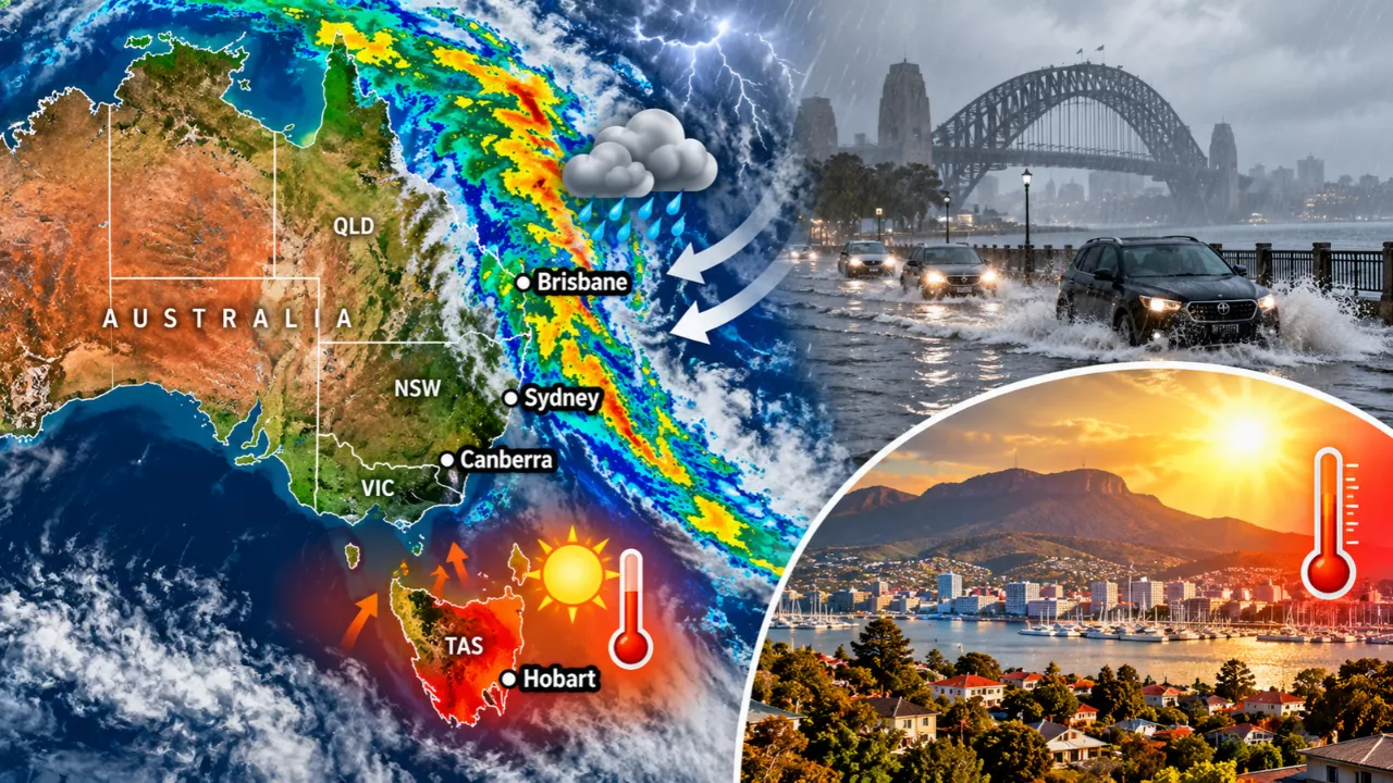
Australia is seeing two very different weather stories at once. Heavy rain and flooding in eastern Australia is building across Queensland and northern NSW, while Tasmania’s capital is sweating through heat more typical of mid-summer. Hobart hit 30.4°C on Tuesday, its hottest October day in nine years. A slow-moving high pressure system over the Tasman Sea is steering moist air into the east coast while pushing warm air over the south.
Why Heavy Rain and Flooding in Eastern Australia Is Building
Persistent showers and thunderstorms are expected across parts of Queensland and NSW every day this week. The heaviest falls are forecast from central and southern Queensland into northern NSW, with a particularly intense burst likely on Thursday and into Friday morning. Forecasters say a broad zone from central Queensland to the NSW north-east could collect more than 100 millimetres, with some models pointing to 100 to 150 millimetres. That is roughly a season’s worth of rain in a few days. Minor flooding has already been recorded in parts of central Queensland, and the ground is wet from heavy falls earlier this month, so there is little room to absorb more.
Which Areas Are at Greatest Risk
The high-risk region stretches from Rockhampton south-west towards Roma and Goondiwindi, then south towards Coffs Harbour. It also extends inland to the Central Highlands, the Darling Downs, and the Northern Tablelands and Slopes of NSW. In some spots, up to 100 millimetres could fall in a single day, which raises the risk of flash flooding.

| Region | What to expect | Main risk |
|---|---|---|
| South-east Queensland | Heaviest bursts Thursday–Friday | Flash and river flooding |
| Northern NSW (Northern Rivers to Coffs Harbour) | 100–150 mm possible over the week | Flash flooding, road closures |
| Central Queensland | Minor flooding already recorded | Rivers rising with more rain |
| Northern Tablelands and Slopes | Storms extending inland | Localised flash flooding |
| Hobart and southern Tasmania | Mid-to-high 20s until a weekend cold front | Heat stress, then a sharp cool-down |
Why Hobart Is Baking While the East Gets Soaked
Hobart’s average October maximum is about 17°C, and it is normally around 10°C cooler than Brisbane at this time of year. This week it has been running well above that average, and the city is on track for a new October record of more than six consecutive days at or above 20°C. The same high that feeds moisture into the east is helping hold the heat over Tasmania. Relief is coming. A cold front and rain are forecast to sweep across the state this weekend, with Hobart’s maximums expected to fall to the high teens on Saturday and around 16°C by Sunday.
How to Stay Safe in Floods and Heat
Whether you are in the wet zone or the hot one, a few habits make a real difference:


- Never drive, walk or ride through floodwater. Depth and current are hard to judge, and road surfaces can be washed away underneath.
- Check official warnings regularly. The Bureau of Meteorology and your state emergency service post updates as conditions change.
- Move vehicles and valuables away from low-lying areas and creek lines before heavy rain arrives.
- Call the SES on 132 500 for flood help, and dial 000 in a life-threatening emergency.
- In the heat, drink water often, avoid strenuous activity in the afternoon, and check on older neighbours and young children.
Frequently Asked Questions
How much rain could fall in eastern Australia this week?
Forecasters are tipping 100 to 150 millimetres across parts of Queensland and northern NSW, with up to 100 millimetres possible in a single day in the worst-hit areas.
Why is Hobart so hot in October?
A slow-moving high pressure system over the Tasman Sea is drawing warm air over Tasmania while pushing moisture towards the east coast. Hobart reached 30.4°C on Tuesday.
When will the heat in Hobart end?
A cold front is forecast to cross Tasmania this weekend. Temperatures should drop to the high teens on Saturday and about 16°C on Sunday.

Is flash flooding likely?
Yes, in the high-risk areas. Heavy bursts on already wet ground raise the chance of flash flooding, especially on Thursday and Friday.